|
Record 2680/5355 |
|
Description
|
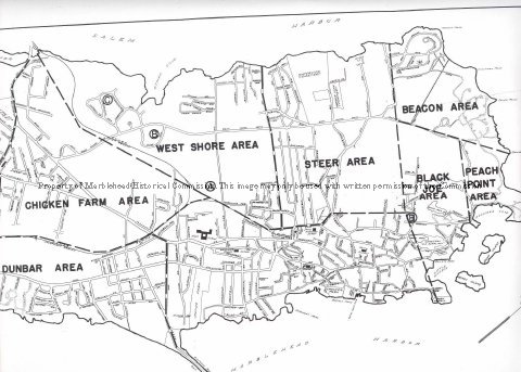
| Part of a map of Marblehead which does not show the Neck. The town has been divided into 10 area with nine having labels. They are: Forest Area, Clifton Area, Chicken Farm Area, Dunbar Area, West Shore Area, Steer Area, Beacon Area, Peach (sic) Point Area and Black Joe Area. The tenth area has no label and is the oldest part of the town next to the harbor from the Old Burial Hill to the old high school on Pleasant Street. |
Marblehead
-Archives Catalog
-Copyright Marblehead Historical Commission
COPYRIGHT INFORMATION ~ Contact the Marblehead Historical Commission for rights to use this image.
| Map of Marblehead |
COPYRIGHT INFORMATION ~ Contact the Marblehead Historical Commission for rights to use this image.