|
Record 3869/5355 |
|
Description
|
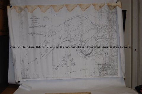
| A rolled map titled "Plan of Fort Sewall and its Site. Marblehead, Mass.". Map scale is 1" to 50'. The upper left corner is labelled Drawer 18, Sheet 38. Written on the map are the following: "Traced from a tracing in the Office, the original of which was sent to Engineer Dept. by Maj. C. E. Blunt, Corps of Eng'rs, July 14, 1865, as by his signature"; "U. S. Engineer Office, Boston, Aug. 6, 1869. Sent to Office of Chief of Engineers, Washington, D.C. with letter of this date, H. W. Benham. |
Plan of Ft. Sewall and its Site
-Archives Catalog
-Copyright Marblehead Historical Commission
COPYRIGHT INFORMATION ~ Contact the Marblehead Historical Commission for rights to use this image.
| Fort Sewall Plan |
COPYRIGHT INFORMATION ~ Contact the Marblehead Historical Commission for rights to use this image.