Shipwrecks of Boston's North Shore
Archives Catalog
|
|
|
| Collection |
General Collection |
| Date |
1988 |
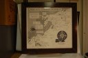
| Abstract |
Framed print of map showing locations of shipwrecks in the Marblehead area. The map was done by Raymond H. Bates, Jr. in 1988 |
| Home Location |
Wall in Volunteer Office |
| Object ID |
2009-008-00073 |
| Object Name |
Map |
| People |
Bates, Raymond |
| Search Terms |
Shipwrecks of Boston's North Shore map |
| Title |
Shipwrecks of Boston's North Shore |
|
|
COPYRIGHT INFORMATION ~ Contact the Marblehead Historical Commission for rights to use this image.
|
|
|
Rev. 2.0 2/2013 Contact the Historical Commission at 781-639-3425 or e-mail us (please include the "Object ID" number, not the Record Number)
historic@marblehead.org
Last modified on: February 22, 2013
|