|
|
| Catalog date |
05/21/2007 |
| Category |
8: Communication Artifact |
| Classification |
Maps
Streets & Byways |
| Collection |
General Collection |
| Date |
September 6. 1959 |
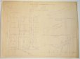
| Abstract |
A map showing the plan for dividing up the lots on Clifton Heights Lane and Joel Road, both off of Atlantic Ave. Also a profile of a proposed sewer and deain easement for Joel Road. |
| Home Location |
GG Pink Room Flat File Drawer#2 |
| Object ID |
2007-201-02129 |
| Object Name |
Map |
| People |
Parsons, John W. |
| Search Terms |
Marblehead maps
Atlantic Ave. |
| Sub-category |
Documentary Artifact |
| Subjects |
Maps
Streets |
|
|
COPYRIGHT INFORMATION ~ This image is the property of the Marblehead Historical Commission and may not be used in any form without prior permission. When using this image with permission, the credit information should be in the following format: Image courtesy of the Marblehead Historical Commission, Marblehead, MA.
|
|
|
Rev. 1.0a 1/2009 Contact the Historical Commission at 781-639-3425 or e-mail us (please include the "Object ID" number) at: butlerw@marblehead.org
Last modified on: January 05, 2009
|