|
Record 1279/1387 |
|
Description
|
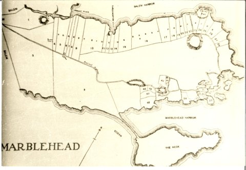
| A B&W photo of a portion of a Marblehead map from about 1650 to 1700. The map shows mainland Marblehead and the Neck, lots and lot numbers, also the "Ancient Highway" from Salem. The west shore shows Darby's Fort (on Naugus Head) and "The Ferry". |
Marblehead Map segment
-Topic: Around town
-This image is the property of the Marblehead Historical Commission
COPYRIGHT INFORMATION ~ This image is the property of the Marblehead Historical Commission and may not be used in any form without prior permission. When using this image with permission, the credit information should be in the following format: Image courtesy of the Marblehead Historical Commission, Marblehead, MA.
| Marblehead Map segment |
COPYRIGHT INFORMATION ~ This image is the property of the Marblehead Historical Commission and may not be used in any form without prior permission. When using this image with permission, the credit information should be in the following format: Image courtesy of the Marblehead Historical Commission, Marblehead, MA.