|
Record 130/5355 |
|
|
|
Description
|
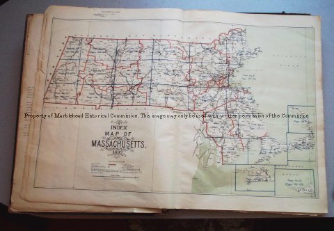
| An Atlas of Massachusetts consisting of: 56 Maps of which each covers two pages with the backs blank 27 of the 56 are "Atlas Plates" numbered one through twenty-seven 1 is a map of Massachusetts showing which part of the state is covered by the "Atlas Plates" 28 are street maps of some of the cities of the state, none are maps of towns. All the maps are bound in a book with and index of various location in the state (not cities or towns) such as post offices, ponds, hills, islands and other geographical features. It has a preface which list many of the local civil engineers and surveyors who assisted in compiling the information. |
Atlas of Massachusetts
-Archives Catalog
-Copyright Marblehead Historical Commission
COPYRIGHT INFORMATION ~ Contact the Marblehead Historical Commission for rights to use this image.
| Map of Massachusetts |
COPYRIGHT INFORMATION ~ Contact the Marblehead Historical Commission for rights to use this image.