|
Record 131/5355 |
|
|
|
Description
|
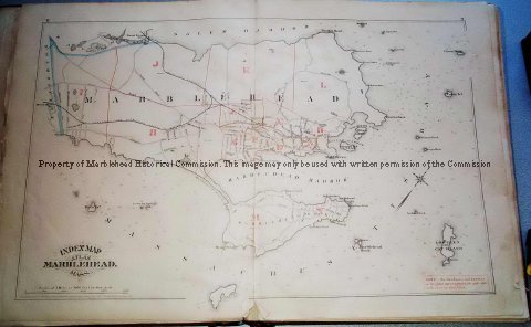
| An atlas of street maps of Marblehead consisting of 14 double page plates. One plate covers the whole of the town and 13 are enlarged section of the town. Each plate is labeled with a letter from A through N. Plate "C" is missing which contains the area bounded by Washington Street at Pearl Street to Pleasant Street, Pleasant Street to Spring Street, Spring Street to what is now Evans Road, along Evans Road to approximately Shepard Street then to what is now the corner of Farrell Lane and Pond Street, across vacant land to the corner of Back Street (now Elm Street) and Pearl and down Pearl to the point of origin. |
Atlas of Marblehead, Massachusetts
-Archives Catalog
-Copyright Marblehead Historical Commission
COPYRIGHT INFORMATION ~ Contact the Marblehead Historical Commission for rights to use this image.
| Atlas of Marblehead |
COPYRIGHT INFORMATION ~ Contact the Marblehead Historical Commission for rights to use this image.