|
Record 364/5355 |
|
Description
|
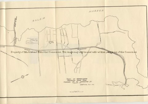
| A map of the West shore of Marblehead and Salem Harbor showing the proposes road which became West Shore Drive. It starts at the corner of Norman Street and Gingerbread Hill, follows Beacon Street to Green Street and then directly to the corner of Lafayette Street and Maple Street. It was drawn by Town Engineer, H.B. Breare, dated February 1931. |
Town of Marblehead Proposed Road from Norman St. to Lafayette St, February 1931
-Archives Catalog
-Copyright Marblehead Historical Commission
COPYRIGHT INFORMATION ~ Contact the Marblehead Historical Commission for rights to use this image.
| West Shore Drive 1931 |
COPYRIGHT INFORMATION ~ Contact the Marblehead Historical Commission for rights to use this image.