|
Record 586/1387 |
|
|
|
Description
|
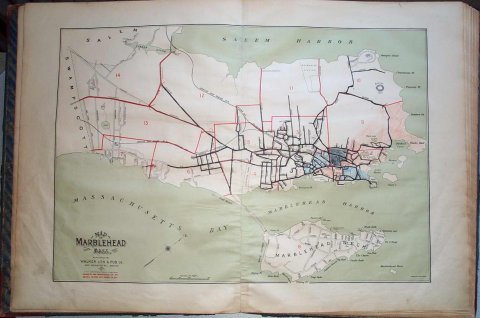
| An atlas of street maps of Marblehead consisting of 15 double page maps, one map of the whole town and 14 street maps of various parts of the town. Each lot is identified with the name of the owner and its square footage. The type of construction and uses are also indicated. |
Atlas of Marblehead, Massachusetts
-Topic: Around town
-This image is the property of the Marblehead Historical Commission
COPYRIGHT INFORMATION ~ This image is the property of the Marblehead Historical Commission and may not be used in any form without prior permission. When using this image with permission, the credit information should be in the following format: Image courtesy of the Marblehead Historical Commission, Marblehead, MA.
| Map of Marblehead |
COPYRIGHT INFORMATION ~ This image is the property of the Marblehead Historical Commission and may not be used in any form without prior permission. When using this image with permission, the credit information should be in the following format: Image courtesy of the Marblehead Historical Commission, Marblehead, MA.