|
Record 631/1387 |
|
Description
|
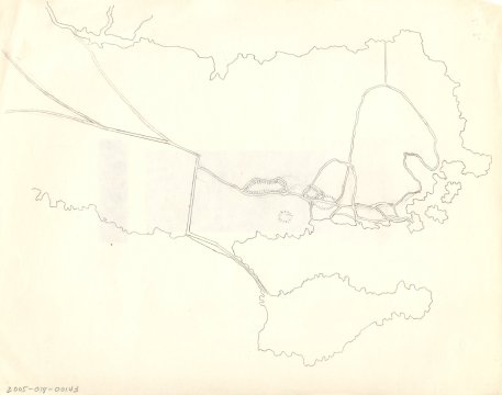
| A hand drawn map of Marblehead showing the old roads leading to the town. It shows the Old Salem Road that crosses Forrest river at Legg's Hill, the two roads that are now Humphrey and Tedesco Streets, the road SE of the marsh behind Devereux Beach that leads to the causeway, the Green Street and Beacon Street "Ways to the Ferry" and Front, Washington and the streets between them. |
(none)
-Topic: Around town
-This image is the property of the Marblehead Historical Commission
COPYRIGHT INFORMATION ~ This image is the property of the Marblehead Historical Commission and may not be used in any form without prior permission. When using this image with permission, the credit information should be in the following format: Image courtesy of the Marblehead Historical Commission, Marblehead, MA.
| Old roads to Marblehead |
COPYRIGHT INFORMATION ~ This image is the property of the Marblehead Historical Commission and may not be used in any form without prior permission. When using this image with permission, the credit information should be in the following format: Image courtesy of the Marblehead Historical Commission, Marblehead, MA.