|
Record 1038/1387 |
|
|
|
Description
|
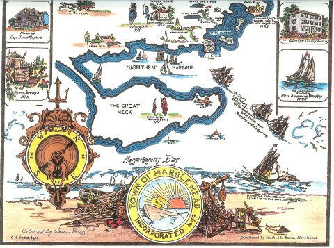
| Print of a hand-colored map of Marblehead originally made by C. H. Snow in 1929 and colored by Warren Perry in 2008. The map shows the outlines of Marblehead peninsula and the Neck, along with historical pieces of information. The map is surrounded by drawings of historical Marblehead buildings and the Hannah. |
C. H. Snow Marblehead Map
-Topic: Around town
-This image is the property of the Marblehead Historical Commission
COPYRIGHT INFORMATION ~ This image is the property of the Marblehead Historical Commission and may not be used in any form without prior permission. When using this image with permission, the credit information should be in the following format: Image courtesy of the Marblehead Historical Commission, Marblehead, MA.
| C. H. Snow Marblehead Map |
COPYRIGHT INFORMATION ~ This image is the property of the Marblehead Historical Commission and may not be used in any form without prior permission. When using this image with permission, the credit information should be in the following format: Image courtesy of the Marblehead Historical Commission, Marblehead, MA.