|
Record 2904/5355 |
|
Description
|
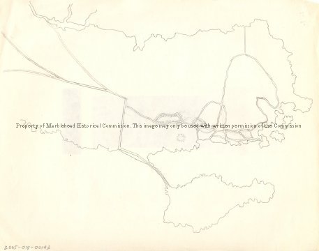
| A hand drawn map of Marblehead showing the old roads leading to the town. It shows the Old Salem Road that crosses Forrest river at Legg's Hill, the two roads that are now Humphrey and Tedesco Streets, the road SE of the marsh behind Devereux Beach that leads to the causeway, the Green Street and Beacon Street "Ways to the Ferry" and Front, Washington and the streets between them. |
(none)
-Archives Catalog
-Copyright Marblehead Historical Commission
COPYRIGHT INFORMATION ~ Contact the Marblehead Historical Commission for rights to use this image.
| Old roads to Marblehead |
COPYRIGHT INFORMATION ~ Contact the Marblehead Historical Commission for rights to use this image.